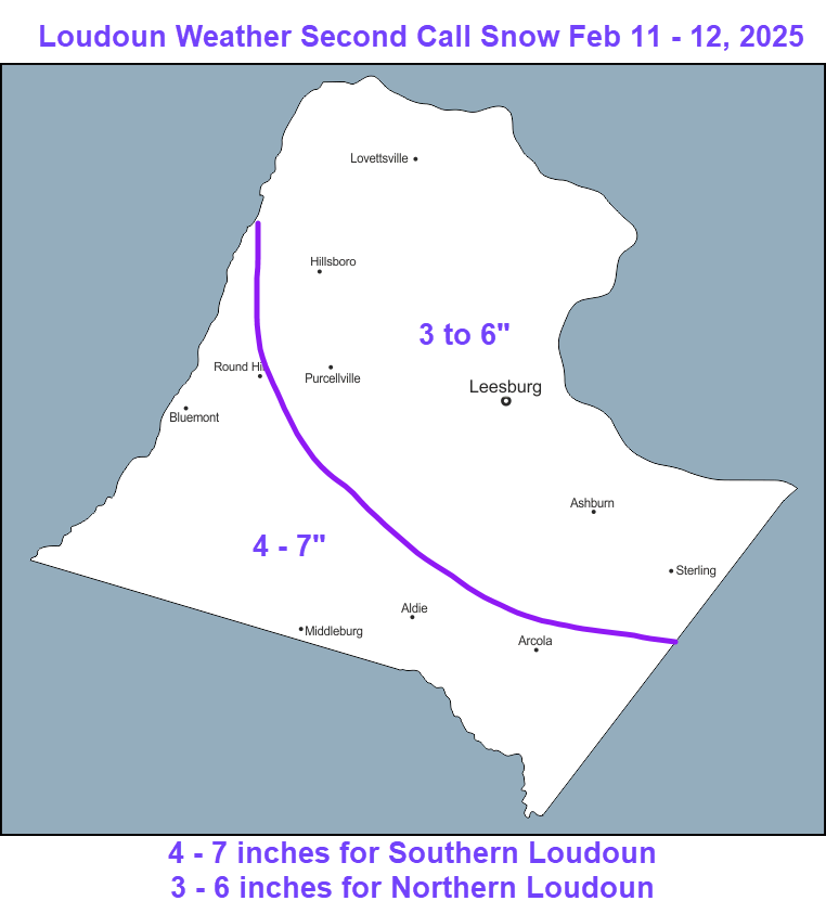
2/10/2025 – UPDATES ON SNOW! Snow should start tomorrow between 11am and 2pm. The snow will not be super heavy but will accumulate. The temps will be at or just below freezing, so it will be easy for salt and the plowers to handle. Snow will get heavier tomorrow night. By the time it wraps up on Wednesday we could see 3 to 6 inches, with southern areas seeing 4 – 7 inches.
Mixed precipitation will be coming back on Wednesday evening and should turn over to rain, but we will need to watch for some icing and the trees may be heavy with the rain and snow combined.
I go over the models in my video on YouTube – if interested – https://lowx.us – nothing fancy about it at all! 🙂
More mixed precipitation looks possible this weekend, but mainly rain from what I can see.
Attached are my thoughts on the amounts.
The forecast:
Today: Hi 42 🌤️ Lo 27 ☁️ – Mostly sunny with light northwest winds, becoming mostly cloudy overnight
Tuesday: Hi 33 ❄️90% Lo 30 ❄️100% – Snow developing in the afternoon with 1 to 2 inches possible, continuing overnight with 2 to 4 more inches
Wednesday: Hi 35 ❄️🌧️100% Lo 33 🌧️100% – Snow mixed with freezing rain in the morning, then changing to rain in the afternoon and continuing overnight
Thursday: Hi 46 ⛅ Lo 25 🌙 – Partly sunny and partly cloudy overnight
Friday: Hi 36 🌤️ Lo 25 ☁️ – Mostly sunny with increasing clouds overnight
Saturday: Hi 41 ❄️🌧️70% Lo 36 🌧️90% – Rain and snow likely during the day, turning to rain overnight
Sunday: Hi 46 ❄️🌧️70% – Rain and snow likely
#loudoun #loudouncountyva #vawx #loudounweather #loudounva #virginiaweather
Please support Tree of Life Ministries, an important organization to me! https://www.tolministries.org
Facebook: https://facebook.com/loudounwx
Twitter: https://twitter.com/loudounwx
Instagram: https://www.instagram.com/loudounweather/