Skip to content
Loudoun Weather

Loudoun Weather

Weather forecasts and information for all of Loudoun County, Virginia. Including Leesburg, Aldie, Waterford, Ashburn, Sterling, Dulles, Hamilton, Purcellville, South Riding. Loudoun Weather is your source for Loudoun County weather forecasts, weather radar and more.

  • Home
  • OCC
  • Forecast
    • Aldie
    • Leesburg Virginia Weather
  • Radar
  • Severe
  • Precip
  • Conditions
  • Temps
  • Tropical
  • Winter
    • 2025 List of Winter Outlooks
    • Winter Impact Index
    • Snow Reports and Depth
    • Ice Impact
    • Ice
  • Articles of Interest
    • So why so hot? What causes heat in the Mid-Atlantic?
    • 10 ways to keep your home cool and save money!
    • June 29th, 2012 Derecho
  • Tweets
  • Toggle search form

Loudoun County Weather Outlook for Thursday, January 29, 2026

Posted on January 29, 2026January 29, 2026 By admin No Comments on Loudoun County Weather Outlook for Thursday, January 29, 2026
1/29/2026
🌬️ Cold Blast Continues
Bundle up! Highs today only reach the low 20s with wind chills making it feel even colder. Another frigid night ahead with lows dropping into the single digits and wind chills below zero prompting a cold weather advisory.

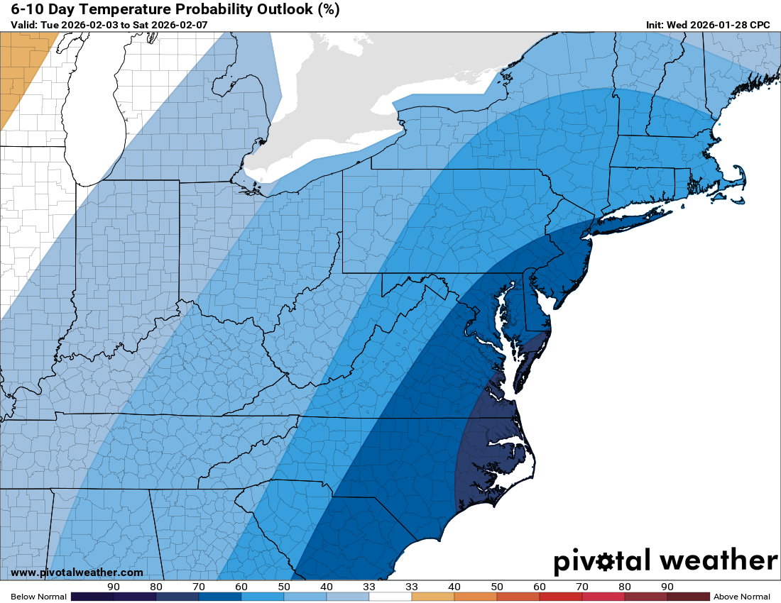
❄️ Brutal Cold Holds Through Saturday
Friday’s high will hover around 20, and Saturday looks even colder with highs stuck in the teens. Not much change in the pattern through the weekend.
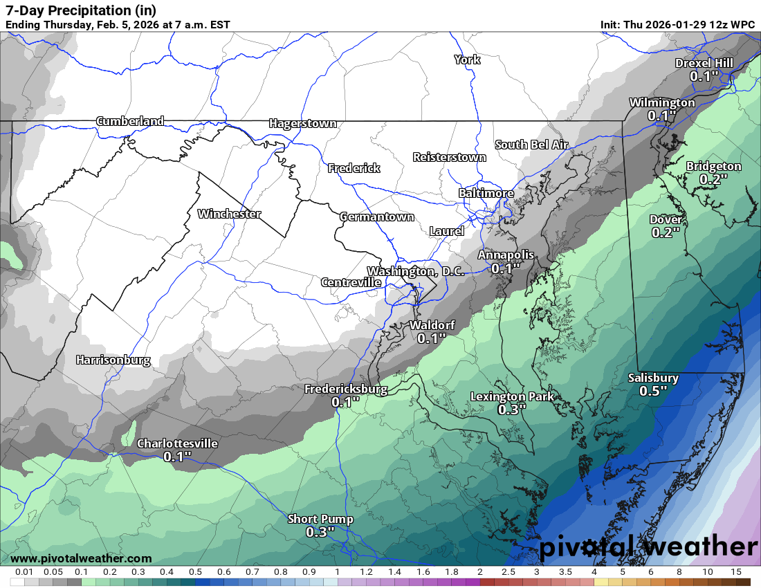
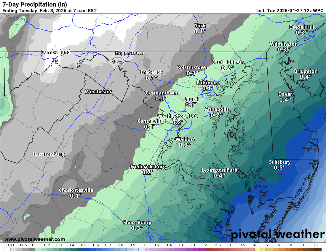
πŸŒ₯️ Watching the South, But Staying Dry
The winter storm we have been tracking will stay to our south and could bring big snow to the Outer Banks and parts of coastal North Carolina and South Carolina. Virginia looks to dodge the snow, except maybe far south and southeast areas into Delmarva.
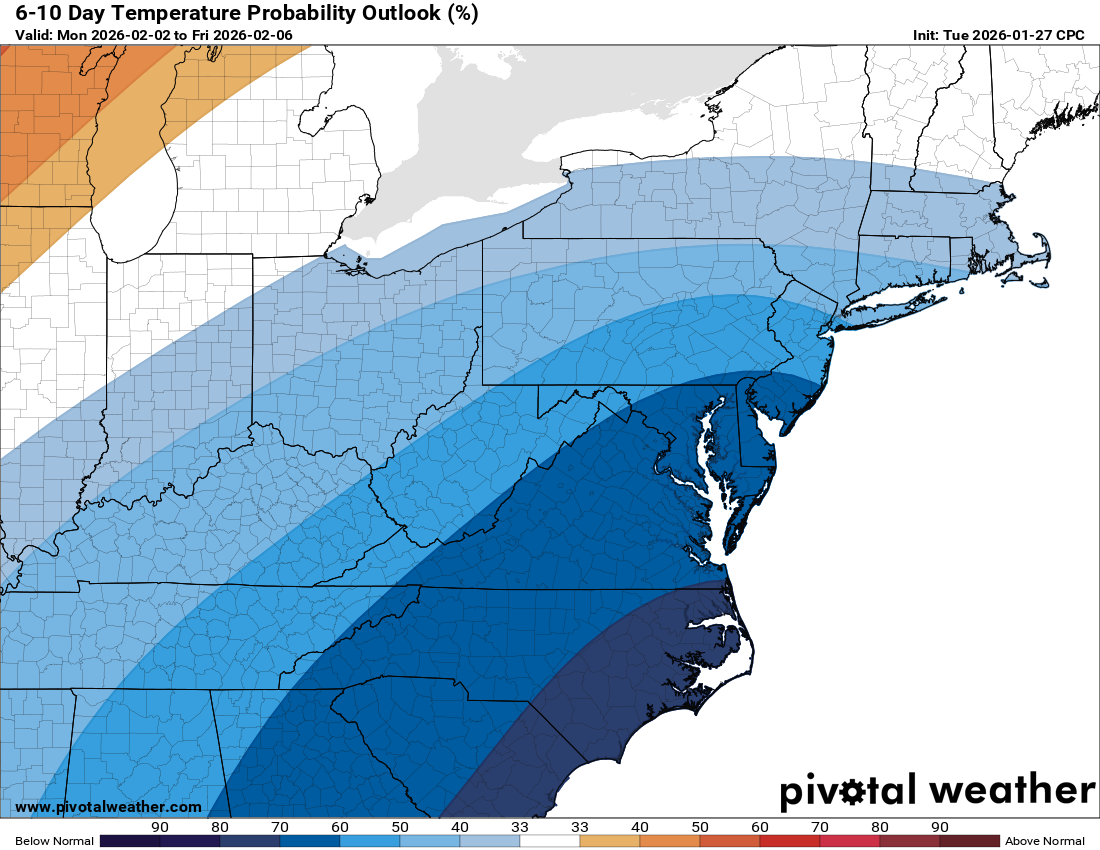
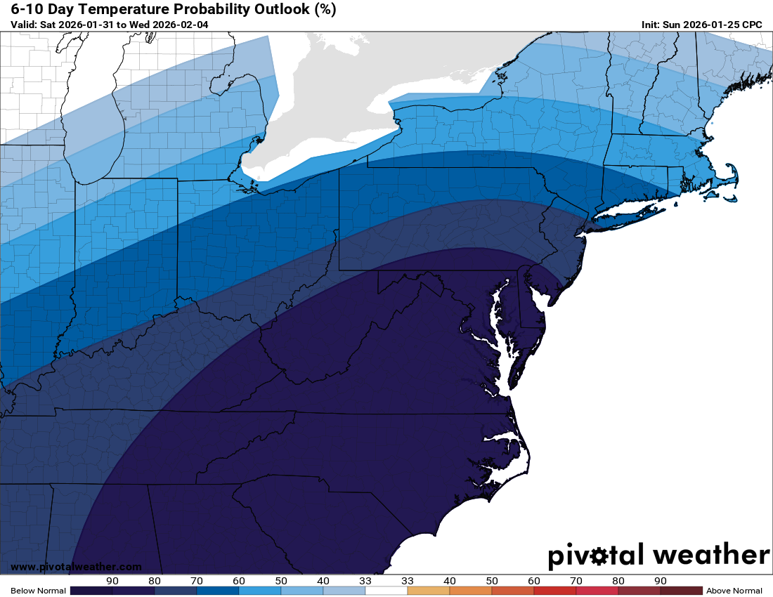
🌑️ Gradual Warm-Up Next Week
Sunday edges back into the 20s, and we could flirt with 32 by Monday. By midweek, highs may climb into the low to mid-30s.

🌨️ Eyes on Late Week
We’re keeping an eye on potential activity later next week. Too early for details, but I will be watching closely.

The forecast:
Today: Hi 21 🌀️ Lo 3 πŸŒ™ – Mostly sunny and cold, becoming partly cloudy overnight

Friday: Hi 20 🌀️ Lo 6 ☁️ – Mostly sunny and chilly, becoming mostly cloudy overnight

Saturday: Hi 18 ☁️20% Lo 8 ❄️20% – Mostly cloudy with a slight chance of afternoon snow, continuing overnight

Sunday: Hi 23 β›… Lo 13 πŸŒ™ – Partly sunny and blustery, clearing at night

Monday: Hi 32 β˜€οΈ Lo 15 πŸŒ™ – Sunny and cold, mostly clear overnight

Tuesday: Hi 35 🌀️ Lo 19 πŸŒ™ – Mostly sunny, becoming partly cloudy overnight

Wednesday: Hi 33 β›… Lo 21 ☁️ – Partly sunny, with increasing clouds overnight

#loudoun #loudouncountyva #vawx #loudounweather #loudounva #virginiaweather

Please support Tree of Life Ministries, an important organization to me! https://www.tolministries.org

Facebook: https://facebook.com/loudounwx
Twitter: https://twitter.com/loudounwx
Instagram: https://www.instagram.com/loudounweather/
On the Web @ https://loudounweather.com
TikTok: https://www.tiktok.com/@loudounweather

image.png
image.png
Uncategorized

Loudoun County Weather Outlook for Wednesday, January 28, 2026

Posted on January 28, 2026January 28, 2026 By admin No Comments on Loudoun County Weather Outlook for Wednesday, January 28, 2026
1/28/2026 – Watching the weekend, but snow is less likely! Will update early afternoon!
❄️ Chilly Day with a Surprise Snow Chance
Highs around 20 today with a 20 to 30 percent chance of snow late this afternoon into early evening. The best chance is in eastern Loudoun, especially near rush hour.

πŸŒ™ Bitter Cold Tonight
Lows drop into the single digits. Highs stay

image.png

around 20 on Thursday and Friday.

🌨️ Watching the Weekend
Highs only in the teens on Saturday. Some snow is possible Saturday night into Sunday. Sunday will be cold and windy as a storm moves off to our east.

🌑️ Slight Warmup Next Week
Highs climb into the 30s on Monday and could push above freezing by Tuesday. That will end a very long stretch of below-freezing weather!

πŸ“… Typical Snow Window
This is the usual stretch for snow. While the trend looks colder and drier, a system could pop up as we head into later next week.

The forecast:
Today: Hi 21 β›… Lo 4 πŸŒ™ – Increasing clouds during the day, becoming partly cloudy overnight

Thursday: Hi 22 β˜€οΈ Lo 5 πŸŒ™ – Mostly sunny during the day, mostly clear at night

Friday: Hi 20 β˜€οΈ Lo 5 ☁️ – Mostly sunny, turning mostly cloudy overnight

Saturday: Hi 17 β›… Lo 10 ☁️ – Partly sunny and cold, mostly cloudy and blustery overnight

Sunday: Hi 23 β›… Lo 13 πŸŒ™ – Partly sunny and breezy, partly cloudy and blustery overnight

Monday: Hi 31 β˜€οΈ Lo 13 πŸŒ™ – Mostly sunny during the day, partly cloudy overnight

Tuesday: Hi 33 β˜€οΈ Lo 20 πŸŒ™ – Mostly sunny with a clear and cold night

#loudoun #loudouncountyva #vawx #loudounweather #loudounva #virginiaweather

Please support Tree of Life Ministries, an important organization to me! https://www.tolministries.org

Facebook: https://facebook.com/loudounwx
Twitter: https://twitter.com/loudounwx
Instagram: https://www.instagram.com/loudounweather/
On the Web @ https://loudounweather.com
TikTok: https://www.tiktok.com/@loudounweather

image.png

image.png

Uncategorized

Loudoun County Weather Outlook for Tuesday, January 27, 2026

Posted on January 27, 2026January 27, 2026 By admin No Comments on Loudoun County Weather Outlook for Tuesday, January 27, 2026
1/27/2026 – Cold weather continues! Watching this weekend, but snow chances are low as of now!

🌬️ Another Cold Day with Frigid Nights Ahead
It stayed cold all day with highs only in the 20s after morning lows dipped to around 5 or 6Β°F. Tonight, we're heading into the single digits again.

❄️ Cold Continues Through Midweek
Wednesday stays chilly with highs in the 20s. A front comes through Wednesday night, knocking temps into the single digits and potentially below zero. Highs Thursday through Saturday stay stuck in the teens.

🌨️ Weekend Storm Likely to Miss Us
We're tracking a coastal storm for Saturday. Most guidance keeps it south, and east of our area, but places like southeastern Virginia and the Carolinas could see heavy snow or even blizzard conditions.

πŸ’¨ Blustery Monday Possible
As that strong storm pulls away to our east, Monday could turn very blustery with gusty winds adding to the cold.

🧀 Next Week: Still Cold
Temps remain below normal, but the bitter cold could ease a bit as we head into February. Stay bundled up and enjoy your Tuesday!

The forecast:
Today: Hi 26 β›… Lo 4 πŸŒ™πŸ₯Ά β€” Increasing clouds through the day, becoming partly cloudy overnight

Wednesday: Hi 21 🌀️ Lo 1 πŸŒ™πŸ₯Ά β€” Mostly sunny during the day, clear and very cold at night

Thursday: Hi 21 🌀️ Lo –1 πŸŒ™πŸ₯Ά β€” Mostly sunny and cold, remaining clear and frigid overnight

Friday: Hi 18 🌀️ Lo –1 πŸŒ™πŸ₯Ά β€” Sunny but very cold, clear and extremely cold at night

Saturday: Hi 17 β›… Lo 7 β˜οΈβ„οΈ30%πŸ₯Ά β€” Partly sunny, with a chance of snow after 1β€―AM (Watching for snow)

Sunday: Hi 23 β›… Lo 12 πŸŒ™πŸ₯Ά β€” Partly sunny and blustery, partly cloudy and cold overnight (Watching for snow)

Monday: Hi 29 🌀️ Lo 15 πŸŒ™πŸ₯Ά β€” Mostly sunny and cold, staying clear at night

#loudoun #loudouncountyva #vawx #loudounweather #loudounva #virginiaweather

Please support Tree of Life Ministries, an important organization to me! https://www.tolministries.org

Facebook: https://facebook.com/loudounwx
Twitter: https://twitter.com/loudounwx
Instagram: https://www.instagram.com/loudounweather/
On the Web @ https://loudounweather.com
TikTok: https://www.tiktok.com/@loudounweather

image.png
image.png
Uncategorized

Loudoun County Weather Outlook for Monday, January 26, 2026

Posted on January 26, 2026January 26, 2026 By admin No Comments on Loudoun County Weather Outlook for Monday, January 26, 2026
1/26/2026 Cold weather advisory in effect for wind chills as low as -9 tonight!
🌬️ Arctic Blast Grips Loudoun This Week
A brutally cold week is underway across Loudoun County. Daytime highs will struggle to escape the 20s and overnight temps are crashing to near or even below 0Β°F.

🌞 Sun Helps, But Watch for Ice
Despite the cold, the sun is strong enough now to cause some melting during the day. But once the sun sets, all that water refreezes quickly. Make sure your drainage is clear to prevent ice buildup.

🏫 School Delays and Closings Likely
With these bitter temps and slick conditions, delays or closings are likely this week. Plan ahead each morning and watch for updates.

❄️ Watching Weekend Snow Potential
The European model is hinting at a potentially significant snowstorm this weekend. Still too far out for details but it's something to watch as we head into Saturday and Sunday.

🧊 Be Safe, Stay Warm
Restock supplies, check on neighbors, and keep pets inside. It’s a harsh stretch of weather so take it seriously and stay safe out there!

The forecast:
Today: Hi 25 🌀️ Lo -2 πŸŒ™πŸ₯Ά – Cloudy early, then becoming mostly sunny and clear overnight

Tuesday: Hi 27 β˜€οΈ Lo 5 β›…πŸ₯Ά – Sunny with a few clouds

Wednesday: Hi 22 🌀️ Lo 0 β›…πŸ₯Ά – Mostly sunny during the day, partly cloudy overnight

Thursday: Hi 19 🌀️ Lo -3 πŸŒ™πŸ₯Ά – Mostly sunny and clear overnight

Friday: Hi 16 🌞 Lo 2 πŸŒ™πŸ₯Ά – Sunny and calm through the day and night

Saturday: Hi 22 β˜€οΈ Lo 5 πŸŒ™πŸ₯Ά – Sunny and clear (watching for potential snow)

Sunday: Hi 26 🌀️ Lo 7 πŸŒ™πŸ₯Ά – Mostly sunny and clear (watching for potential snow)

#loudoun #loudouncountyva #vawx #loudounweather #loudounva #virginiaweather

Please support Tree of Life Ministries, an important organization to me! https://www.tolministries.org

Facebook: https://facebook.com/loudounwx
Twitter: https://twitter.com/loudounwx
Instagram: https://www.instagram.com/loudounweather/
On the Web @ https://loudounweather.com
TikTok: https://www.tiktok.com/@loudounweather

image.png
image.png
Uncategorized

1/22/2026 Major Winter Storm Coming

Posted on January 22, 2026January 22, 2026 By admin No Comments on 1/22/2026 Major Winter Storm Coming
1/22/2026 Major Winter Storm

I cannot help but note that it was ten years ago today that we experienced the Blizzard of 2016. That was the biggest snow I have ever seen, with 37 inches as best I could measure, and it was pure powder. It was a beautiful thing.

The setup for this storm
For the first time in many months, the southern jet stream will contribute to a storm system for our region. This has been the missing ingredient for big precipitation events and is why this storm brings such a strong chance of snow. Energy from the northern jet stream and southern jet stream will merge, or phase, helping to create a significant wintry event. How strongly these two systems combine is delicate.

If they combine too early or become too strong, warmer air will move overtop the cold air and bring more sleet and less snow. That looks very likely for areas from Richmond up to just south of Washington DC. Snow will fall first, then sleet will pile on top of it, creating a crusty layer. This warm air aloft intrusion will slowly progress north and west and will likely impact Loudoun. Areas farther east will see it first, but I suspect all of us will experience a period of sleet.

As of now, sleet looks like it will mark the end of the storm, with most of the significant precipitation already fallen. However, warm air is sneaky and often arrives sooner than snow lovers would like. Because of this, there is a wide range of possible outcomes, all dependent on how that warmer air behaves.

If we remain snow, we will be well into double digit totals. As of now, we have no idea how impactful the warm air aloft intrusion will be. Short range models over the next 24 hours will begin to give us clues. If the storm remains less merged or phases slowly, the warmer air may not make it as far north. That is still a possibility. Fine tuning snow amounts will be a challenge.

This is a huge winter storm
This will be a seriously impactful storm due to ice from Texas eastward to the East Coast, with a wide swath of heavy icing. That heavy icing will reach central Virginia, especially south of Richmond. This will lead to states of emergency and will impact all of us due to disrupted supply routes and the effects of prolonged cold.

The areas hardest hit by ice will have the greatest needs for electricity restoration and supplies. I have attached the national watches map below. This is a massive area being impacted by this storm.

Timing
I would not be surprised to see light snow begin by early Saturday evening. Overnight Saturday and through the first half of Sunday, snow will fall heavily. Rates of one to two inches per hour are possible. Snow may struggle to fully end until Sunday night, although storms like this often wind down faster than expected.

This could depend on whether upper level support tracks directly over us. If it does, we could see additional snowfall.

Totals
My breakdown below reflects my confidence in each range.

β€’ 4 inches, 95 percent certain
β€’ 5 to 8 inches, 80 percent certain
β€’ 8 to 10 inches, 65 percent certain. This is what I expect for most areas, but I need short range model details to increase confidence, especially regarding how much sleet falls versus snow
β€’ 10 to 12 inches, 50 percent certain
β€’ 12 to 14 inches, 30 percent certain
β€’ 14 inches or more, 20 percent certain

I will provide more refined totals later today and tonight.

Cold air
This system will leave very cold air behind, which greatly worsens impacts in ice storm areas. For all of us, it means travel, school, and business impacts will be amplified by nighttime temperatures that could dip below zero. This is a time to check fuel sources and backup options if needed, and to check on neighbors.

Beware the hype train
Whenever big storms approach and long range models hint at additional activity, news outlets and social media amplify it aggressively. I am watching future potential, but there is no way to know anything meaningful about the long range until we get past this storm. We can talk about that when it makes sense. For now, let us focus on this system first.

Be prepared, not scared
I would adjust travel plans and prepare, but do not panic. Many in Loudoun have the resources and ability to help one another. I expect there will be opportunities to help those who are impacted far worse than we are. This is a sizable storm, but we will be alright. Pray for those in the ice impacted areas and prepare as best you can. That is all any of us can do.

Look for mid-day and evening updates.

#loudoun #loudouncountyva #vawx #loudounweather #loudounva #virginiaweather

Please support Tree of Life Ministries, an important organization to me! https://www.tolministries.org

Facebook: https://facebook.com/loudounwx
Twitter: https://twitter.com/loudounwx
Instagram: https://www.instagram.com/loudounweather/
On the Web @ https://loudounweather.com
TikTok: https://www.tiktok.com/@loudounweather

image.png

image.png


Uncategorized

Posts pagination

1 2 … 127 Next
Latest Radar from the National Weather Service
National Weather Forecast from https://www.wpc.ncep.noaa.gov/#page=ovw
National Forecast from the Weather Prediction Center
Regional Precipitation
Precipitation Forecast from the National Weather Service
  • Instagram
  • YouTube
  • Facebook
  • Instagram
  • Facebook
  • YouTube

Join the Mailing List

Archives

  • January 2026
  • December 2025
  • November 2025
  • October 2025
  • September 2025
  • August 2025
  • July 2025
  • June 2025
  • May 2025
  • April 2025
  • March 2025
  • February 2025
  • January 2025
  • December 2024
  • November 2024
  • October 2024
  • September 2024
  • August 2024
  • July 2024
  • June 2024
  • May 2024
  • December 2023
  • October 2023
  • September 2023
  • August 2023
  • June 2023
  • April 2023
  • March 2023
  • February 2023
  • January 2023
  • December 2022
  • November 2022
  • October 2022
  • September 2022
  • August 2022
  • July 2022
  • June 2022
  • April 2022
  • February 2022
  • January 2022
  • December 2021
  • November 2021
  • October 2021
  • September 2021
  • August 2021
  • July 2021
  • June 2021
  • May 2021
  • March 2021
  • February 2021
  • January 2021
  • December 2020
  • July 2020
  • June 2020
  • May 2020
  • January 2020
  • December 2019
  • November 2019
  • October 2019
  • September 2019
  • August 2019
  • July 2019
  • June 2019

Categories

  • Alerts
  • Forecast
  • Uncategorized

Meta

  • Log in
  • Entries feed
  • Comments feed
  • WordPress.org

Current Advisories for Loudoun County

Copyright © 2026 Loudoun Weather.

Powered by PressBook WordPress theme