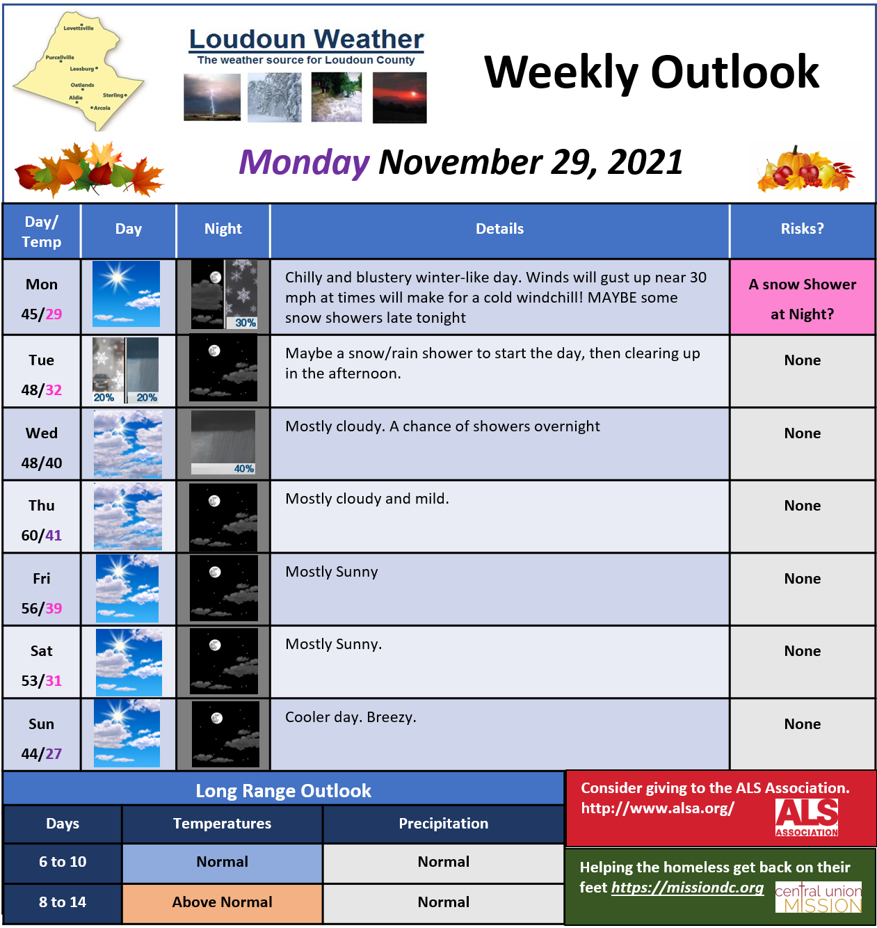
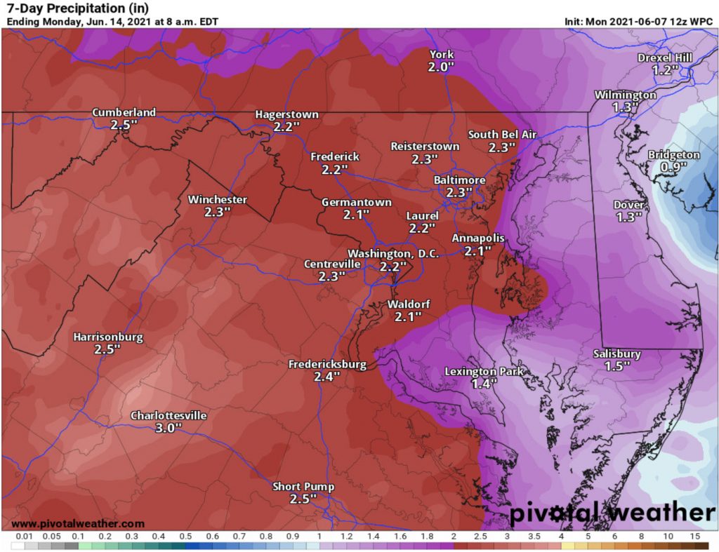
Loudoun County Weather Outlook for Monday, November 29, 2021

Super hot week ahead with daily chances of showers and storms! The Storm Prediction Center has outlined the area for a Marginal Risk of Severe! Heat indexes will all up near 100 many days this week!
Later this week looks the same as the start. We have to watch how things play out Sunday as some heavier rains could be possible
The Severe Storm Outlook for the next three days from the Storm Prediction Center
Day One and Three Looks has a Marginal Risk for Severe Storms
Storm Prediction for the next three days from Storm Prediction Center
Precipitation could be higher locally due to showers and storms. A better risk of rain will be Sunday, but we will have to wait and see.
Always speculation in the Long-Range. As of now, precipitation looks above normal in the 6 to 10 days, and Normal beyond that.
Trends are looking good for some cooler air in the longer-range, but that is way off. It is hot this time of year!
The heat STINKS! HATE IT! We will get a break after Wednesday, but this week looks wet! Maybe two to three inches of rain possible! We need the deficit erased in some areas so this will help. The humidity and heat will remain, but then a “backdoor” front will move through.. but how far has been a bit of a question. If it hangs in the area, we could see some flooding! We will have to watch. Severe does not look likely, but, with warm weather, a pulse severe storm always seems possible. By Thursday and Friday, that front will hopefully clear the area. If so, the next weekend will be so much cooler and dry… that is a possibility. UNFORTUNATELY, there is a possibility that the front does not and we remain wetter than forecast. So I would say the long-range is unsure. With that front pushing to the south, we will eventually clear out and stay cooler and drier than normal for a bit! YAY!
For now, get those drains cleared out if they have grass or anything blocking them, and expect some downpours this week with afternoon and evening storms.
Warmer today and pretty cloudy. Highs will get to near 80. About the same for Wednesday with a chance of a shower and MAYBE a Storm
There is a good chance of showers and storms Thursday and Friday. Highs will be around 80 and the humidity will be higher. There is a chance that the Thursday storms could be severe! The Storm Prediction Center has outlined the area for a slight risk for severe storms
The Rain outlook through Sunday is not too much. This is from the Weather Prediction Center.
Things start looking summer-like with highs pushing into the Mid and upper 80s this weekend. The warmer/hotter trends look to continue into next week.