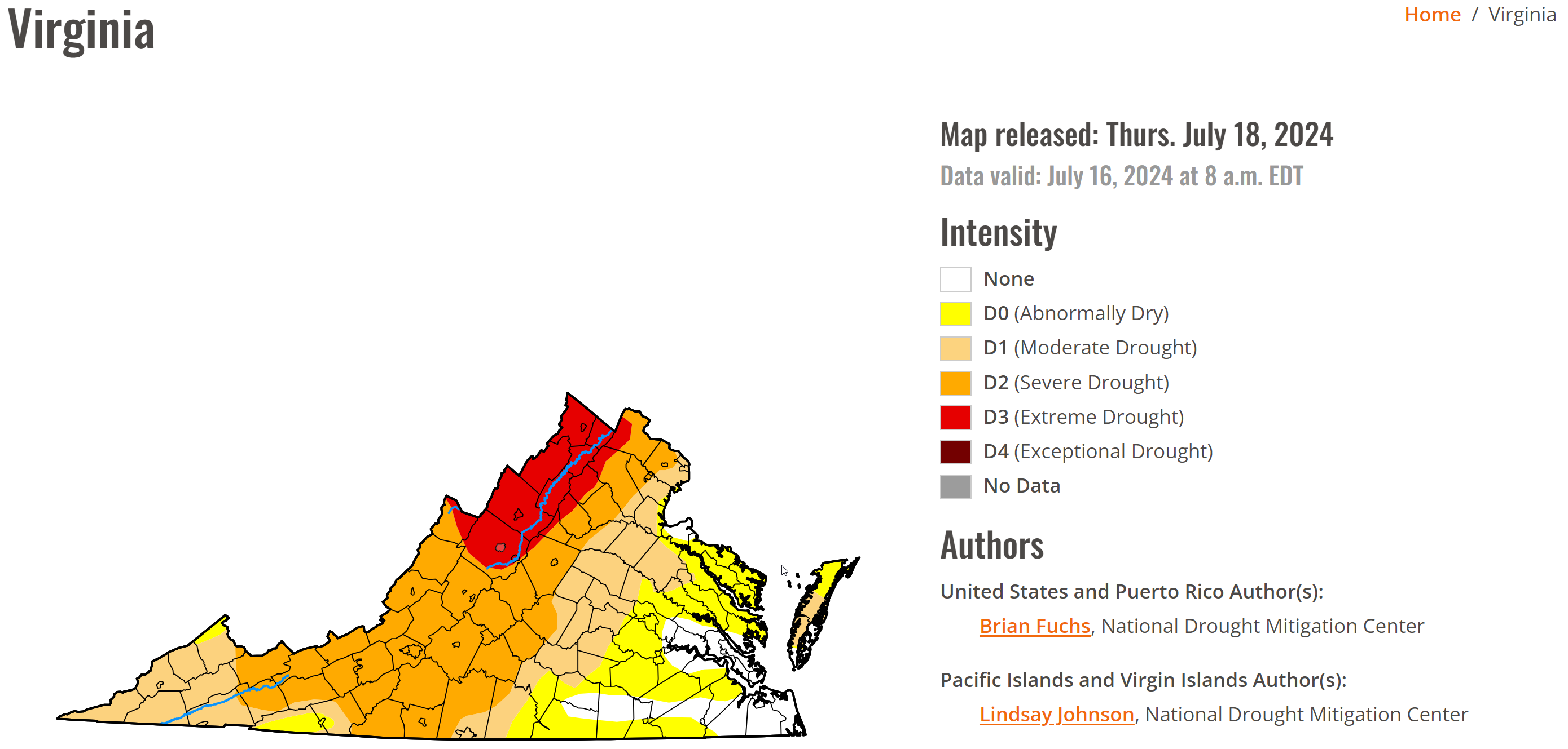
The drought has gotten worse and is extremely bad in far western Loudoun. The latest drought monitor shows Extreme Drought. Yesterday's rain was around a quarter to half an inch for many, but many did not see that much.
We are entering an unsettled time, and I am hopeful some rain chances will pan out over the next week! We need it bad.
Temps will be near normal, which, for this time of year, is the upper 80s to 90 degrees.
YES, we get a break from the humidity today and tomorrow which will make it nicer to be outside.
The extended forecast is showing temperatures slightly above average and slightly above normal rain chances.
The forecast that does show quite a few chances for rain starting Saturday:
Today: Hi 88 🌤️ Lo 63 🌙 – Mostly cloudy with north wind around 7 mph during the day and partly cloudy with north wind 3 to 6 mph at night.
Friday: Hi 88 ☀️ Lo 68 🌙 – Sunny with north wind around 6 mph becoming calm in the afternoon.
Saturday: Hi 83🌤️⛈️50% Lo 66 ⛈️ 30% – Mostly cloudy with a chance of showers and thunderstorms in the afternoon.
Sunday: Hi 89 🌤️⛈️ 30% Lo 68 🌧️ 30% – Mostly sunny with a chance of showers and thunderstorms in the afternoon. Mostly cloudy with a chance of showers and thunderstorms at night.
Monday: Hi 87 🌤️⛈️ 50% Lo 69 🌧️ 40% – Partly sunny with a chance of showers and thunderstorms in the afternoon. Mostly cloudy with a chance of showers and thunderstorms at night.
Tuesday: Hi 88 🌤️⛈️ 60% Lo 70 🌧️ 60% – Partly sunny with showers and possibly a thunderstorm. Mostly cloudy with showers and thunderstorms likely at night.
Wednesday: Hi 88 🌤️⛈️ 70% – Partly sunny with showers and possibly a thunderstorm.
#loudoun #loudouncountyva #vawx #loudounweather #loudounva #virginiaweather
Please support Tree of Life Ministries, an important organization to me! https://www.tolministries.org