Mostly cloudy today and warmer. Tomorrow will be hot and have a chance of strong to severe storms. The weekend starts wet but turns beautiful.. however, the temps will be very cold!
Monday, May 24th, 2021 – Loudoun Weather Outlook
Apologize for my absence. Finally a break in the Heat with a front that is pushing through today. It only is bringing a little rain along with it. Maybe it will help wash a bit of pollen out of the air, but, unfortunately the outcome is less than ideal for the very dry conditions we are experiencing.
NEW – WEEKLY MAILING LIST!
Get this type of post in an email.
The dome of high pressure that WTOP.com (and CNN) are sharing is not uncommon, but the location has been less than ideal as it has kept us dry and our first heat for the summer 2021 season. I hate the heat, but fortunately, the winds and drier air made it a bit more tolerable. The heat did wake up the dormant Cicadas that had been slow to get their act together! But, officially, they are here! They sound like aliens in the trees. I have not seen too many in my backyard, but I am on old farmland. I hear them in the trees at Franklin Park and have heard plenty about it on Nextdoor as well as watched the increase in the Cicada Safari App. They still are not at peak, so I expect to hear more, and your ground may crunchy at this point. The Washington Post had a great article on the Cicadas, and Kevin Ambrose made a great plot of what was reported by readers.
The Weekly Outlook
As far as the week goes, we will be down, then up, then down. Rain today will be light, but keep us much cooler than this last weekend. We will heat up on Wednesday and could see some strong to severe storms in the afternoon. The Storm Prediction Center has outlined the area with a marginal risk for severe storms. A Marginal Risk means that we have a chance for an isolated, short-lived severe storm.
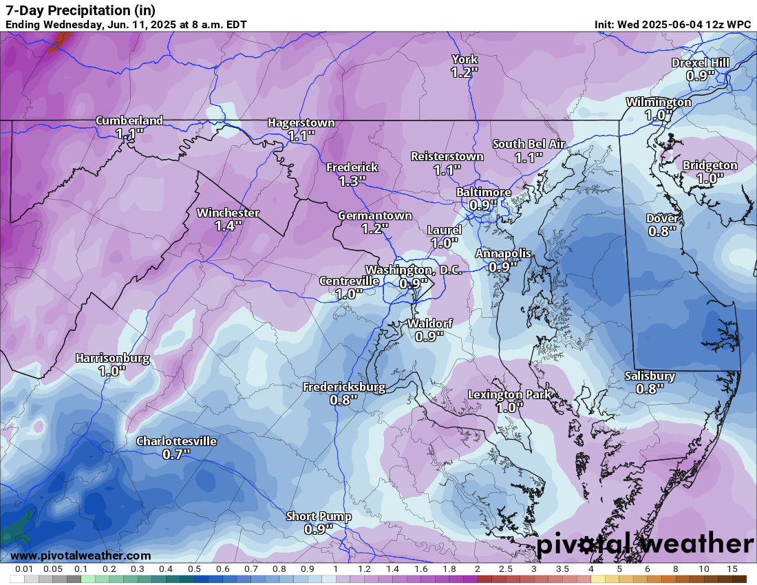
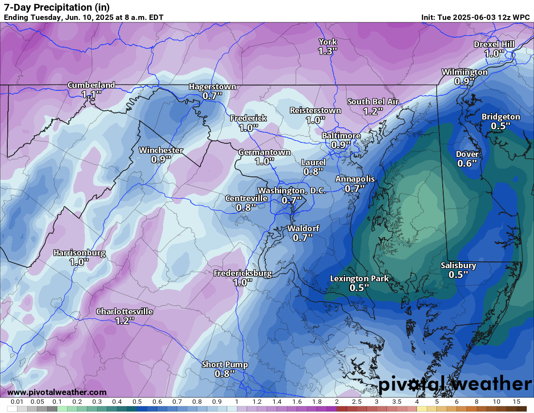
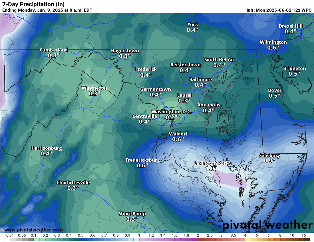
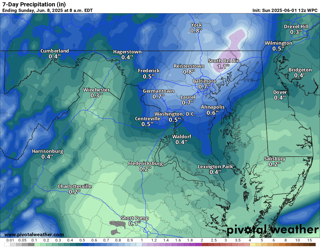
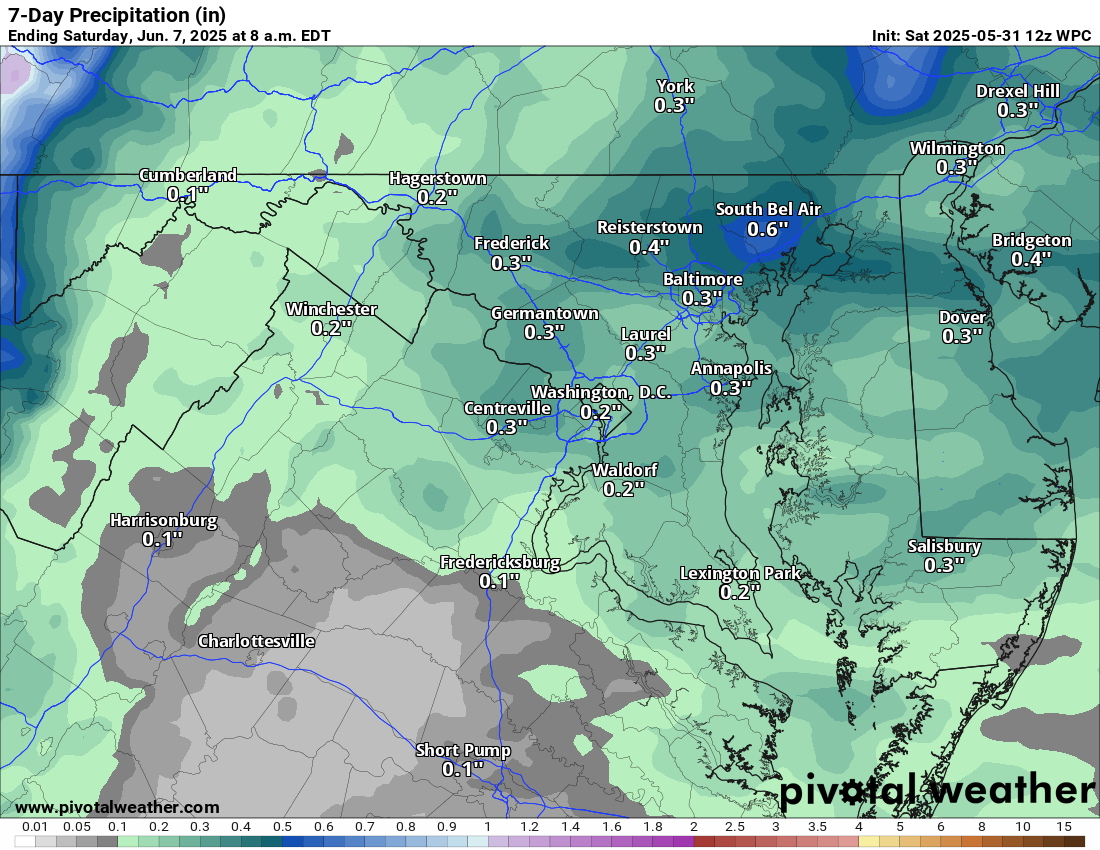
By Friday a front looks like it will sag through the area and end up stalling in the area! That is not good for the weekend sunny outlooks of BBQs and pool openings! We may FINALLY get a little more significant rains, but the exact location of where the most rain falls is still up in the air. There is a concern it could shift south. You can see the current 7-day outlook from the Weather Prediction Center that highlights more precip to the south, which makes sense because the front will be hung up to the south.
The Long Range
Looks like after the cooler conditions this coming weekend, warmer than normal temps will return, but maybe some better chances of rain, which we need!
Outlook from the Climate Prediction Center and Graphics by Pivotal Weather
Monday, March 8, 2021, Loudoun Weather Outlook
3/8/2021 – Loudoun Weather Outlook has Warmer conditions through Friday and then some cooling. We likely will break 70 Thursday, but believe Wednesday and Friday may break 70 as well! With warmer weather… HERE COMES THE POLLEN! Tree pollen starts popping! I know Juniper and Maple are already up and by Friday Pollen levels will be Medium-high for trees! The cooler air next weekend MAY bring some interesting weather Sunday/Monday of the following week with some mixing. I will watch but feel it is unlikely. The longer-range is showing colder than normal temps with above-normal precipitation, which is a change from this dry stretch and the brief warm-up this week.
Pollen Outlook Via Pollen.com
Monday, February 8, 2021, Loudoun Weather Outlook
VERY TOUGH FORECAST AHEAD!
First – A Wintry Period will persist for the next two weeks. This could include multiple winter weather threats as well as some super cold temperatures at times.CONCERNS: Thursday and Thursday night keep fluctuating between a more snowy look and a sleety look. If it turns to icy, we could see enough for a sizable ice storm. It is possible the ice is sleet and not freezing rain which would be better! But someone in Northern and Central Virginia could see a significant ice storm. Please keep posted. BUT, it would be a good idea to prepare for potential power losses.
What in the world is causing this?
- A light southerly wind is overriding some Arctic air that has worked into the area
- The initial amount of cold air above us is cold enough that snow is more likely than other precipitation.
- Southerly winds will bring in warmer air, and that will start to erode the colder air above us.. but the surface cold is dense and being reinforced from the north. So we get the Cold Air Damming set up, which is pretty strong Wednesday Night through Friday. I show a chance of some showers Friday here, but, honestly cold air like this is almost impossible to forecast right and the models always break it down too fast – so do not expect that to be likely.
- On Saturday, a coastal system will be forming along this front that is hanging out in the area all week and causing the wintry weather. This could lead to a significant snowstorm Saturday into Sunday.
Where does that cold front separating colder from just marginal cold set up?
It is super difficult to figure it out, but I would say the confidence through early Thursday is that we are going to see snow. Mid-day Thursday through Thursday Night could be a constant switching back and forth and could end up dominant one type versus the other. The current look at the models leads me to think that we will be competing more with Sleet and Snow than Sleet and Freezing rain.
Saturday is low confidence now, but has possibilities!
Tough week ahead!
Wednesday, February 3, 2021 Loudoun Weather Outlook
2/3/2021 – We did have some more snow showers overnight and it coated the ground. This was the last upper support for the storm that is finally leaving but causing some blowing snow! Cold and windy today with a high in the mid-30s. Milder tomorrow and Friday. We may see some wintry mix tomorrow night, but it should turn to all rain. Showers Friday and one of the mildest days in a long while. Colder air expected next week is starting to fade from the original look. This may come back. We have to watch Sunday and mid next week for the chance for some snow, but I am no longer counting on a snowstorm at either time (but Sunday bears watching)