Slurpee day! 🙂 It will not be as hot and humid today. It definitely feels better this morning.
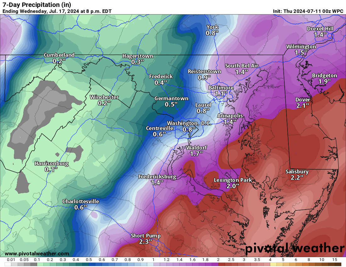
Things are looking better for rain tomorrow, but I don't know how much. We really need the rain. That front stalling I mentioned earlier this week is likely too far east for us, so I would not expect much unless we get some thunderstorms.
It will get dangerously hot again early next week, with several chances of 100+ degrees for the actual high. We will likely meet the Excessive Heat Warning criteria many have wondered about.
The forecast:
Today: Hi 89 Lo 68 🌤️🌙 – Mostly sunny with a light northwest wind, becoming partly cloudy with a light north wind at night.
Friday: Hi 82 Lo 70 ⛈️⛈️ 60% – Partly sunny with showers and thunderstorms likely in the afternoon, continuing into the night with calmer winds.
Saturday: Hi 92 Lo 71 ☀️ ⛈️ 30% – Mostly sunny with a chance of showers and thunderstorms in the afternoon, mostly clear at night.
Sunday: Hi 96 Lo 71 ☀️🌙 🥵 – Sunny and mostly clear.
Monday: Hi 98 Lo 73 ☀️🌙 🥵🌡️ – Sunny and hot, mostly clear at night.
Tuesday: Hi 99 Lo 74 ☀️🌙 🥵🌡️ – Sunny and hot, partly cloudy at night.
Wednesday: Hi 97 ☀️ ⛈️ 40% 🥵 – Mostly sunny and hot with a chance of showers and thunderstorms.
The long-range starts well above normal for temperatures, but for the first time in a while, the longer-range shows us getting closer to normal temperatures. Normal temperatures this time of year are still in the upper 80s, as we are in the hottest stretch of the year! There is still a slightly above-normal chance for rain, but we have not capitalized on this here!
Attached is the rain outlook for the next 7 days. You can see how close the heavier rains are and it is painful for our backyards.

