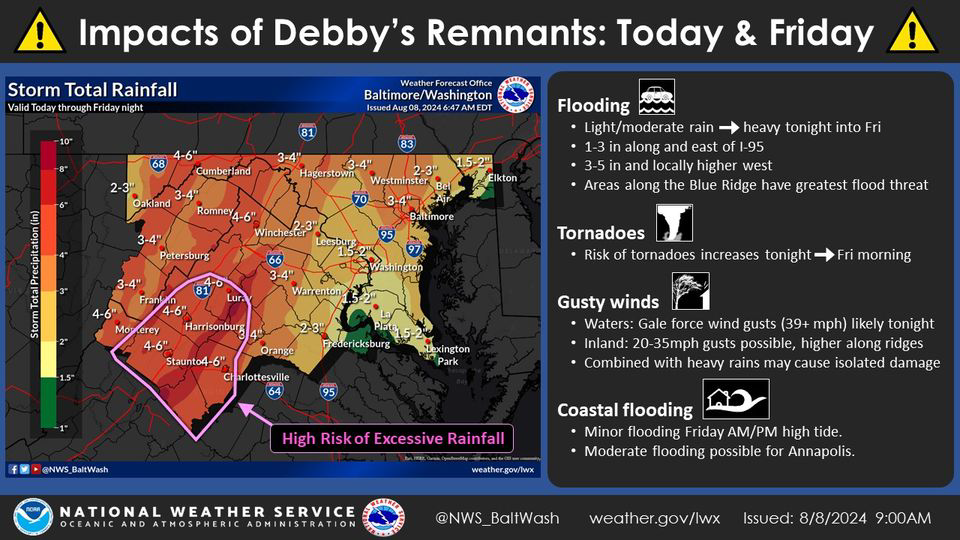
The Forecast and Debby Update – You can see in the attached from US National Weather Service Baltimore/Washington that the remaining rains, directly from Debby, are now in the 1.5 to 3-inch range for Loudoun. I agree with this as the storm is going to be picked up well with the trough, which will help bring cooler/dryer air this weekend and accelerate it northwards. The storm is now expected to be far enough west to keep that heavier swath of rain to the west as well. 1.5 to 3 inches of rain is great. Of note, there could still be training storms that happen in localized areas, and these could drop several inches of rain. Where/If these set up will be a radar watching and short-term outlook.
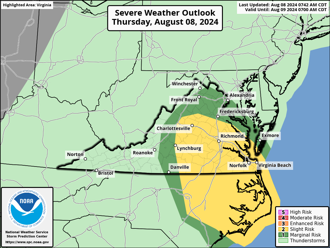
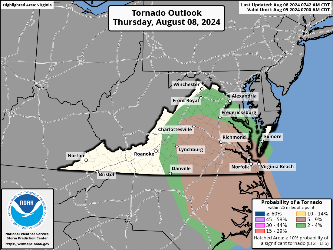
Severe threat: Although there is a risk of tornadoes, it is not that great. I've attached the outlook, and I'll be watching for updates later as the storm approaches. Storms could still produce gusty winds.
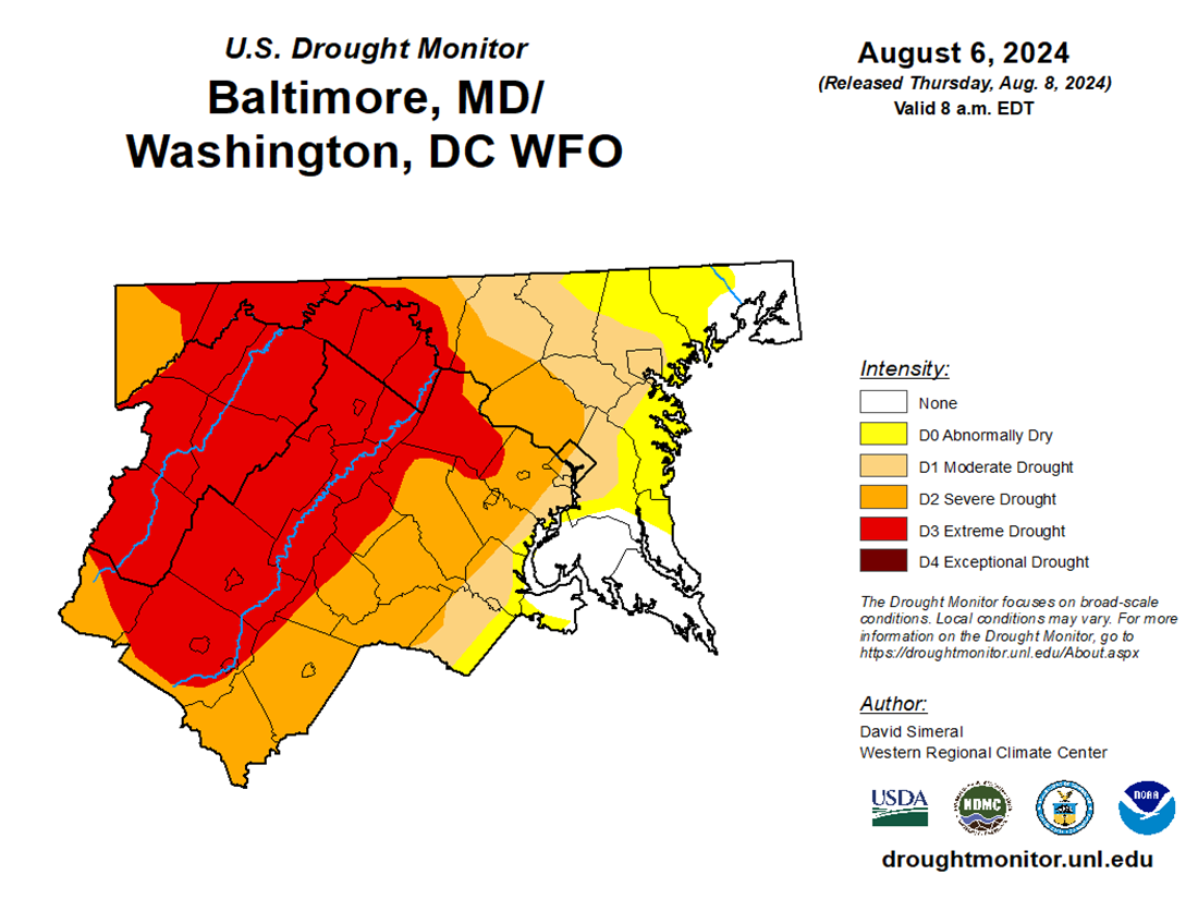
The weather turns so lovely after this, and we look dry from late Friday through next Wednesday. We will see what impacts the recent rain has on the drought, but we will remain in a drought. However, some locations will be dropped from the extreme and moderate drought. I attached the latest monitor that only counted rain through Tuesday morning.
The Forecast:
Today: Hi 78 ⛈️80% Lo 73 ⛈️90% – Showers and possibly a thunderstorm. Some storms could produce heavy rainfall with gusty winds.
Friday: Hi 81 ⛈️100% Lo 67 🌙40% – Showers and thunderstorms, heavy rainfall possible. Chance of showers and thunderstorms at night, becoming partly cloudy later.
Saturday: Hi 82 ☀️ Lo 61 🌙 – Sunny
Sunday: Hi 82 ☀️ Lo 59 🌙 – Sunny
Monday: Hi 84 ☀️ Lo 62 🌤️ – Sunny
Tuesday: Hi 81 🌤️ Lo 62 🌤️ – Mostly sunny
Wednesday: Hi 84 🌤️ Lo 63 🌤️ – Mostly sunny


