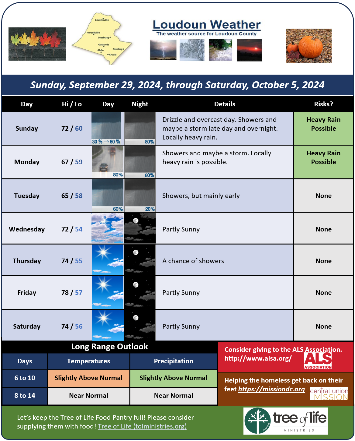
9/29/2024 – After a beautiful but a bit hot day, we are back to socked in clouds and damp conditions. The return of rain is a bit slower than first thought, so the most significant rain will come tonight into tomorrow.
Showers should clear late on Tuesday, and then we will be a bit warmer than I had thought and dry.
Locally heavy rain could come from any thunderstorms so localized flooding could be an issue. The NOAA NWS Weather Prediction Center has far western areas in slight risk for flash flooding.
So wet for a few more days and then we turn warmer and drier. That long range rain storm could still occur after this coming week, but there is a lot of uncertainty that far out!.
The forecast:
Today: Hi 72 🌧️60% Lo 61 🌧️80% – Cloudy with likely showers, patchy fog, and light northeast winds. Showers continue tonight with patchy fog.
Monday: Hi 67 🌧️80% Lo 60 🌧️80% – Showers throughout the day, patchy fog. Possible thunderstorms after 2am.
Tuesday: Hi 65 🌧️60% Lo 58 🌧️20% – Cloudy with likely morning showers, tapering off by evening.
Wednesday: Hi 72 🌤️ Lo 54 🌙 – Partly sunny during the day, becoming partly cloudy overnight.
Thursday: Hi 74 ☀️ Lo 55 🌙 – Sunny skies and mostly clear at night.
Friday: Hi 78 ☀️ Lo 57 🌙 – Sunny and partly cloudy overnight.
Saturday: Hi 74 ☀️ Lo 55 🌙 – Sunny and clear skies throughout the day.
#loudoun #loudouncountyva #vawx #loudounweather #loudounva #virginiaweather
Please support Tree of Life Ministries, an important organization to me! https://www.tolministries.org

