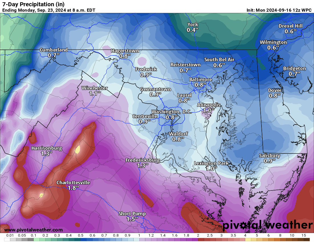
A wet week will start overnight tonight… but — HOW MUCH RAIN?
Late last evening, I was saying I saw a pullback in the rain. A half inch to maybe 1.5 inches is possible, but now it looks like we will have around three-quarters of an inch on average. THIS FORECAST MAY either get wetter or drier based on the models. The challenge is a blocking high to the north. That high pressure stops the system's northward movement from the south. It looked like it would be weaker for a few days, allowing a lot more rain, but the trend is reversing.
Attached is the latest from the Weather Prediction Center – but this has been fluctuating and definitely trending drier than its wetter outlooks.
70s for the week. We may be able to clear by Saturday, but Sunday is looking beautiful.
The forecast:
Today: Hi 74 ☁️ Lo 64 🌧️ 40% – Mostly cloudy with a chance of late-night showers
Tuesday: Hi 74 🌧️ 60% Lo 65 ⛈️ 70% – Showers likely in the afternoon, with thunderstorms possible overnight
Wednesday: Hi 73 🌧️⛈️ 60% Lo 64 🌧️ 50% – Showers and thunderstorms likely during the day, with a chance of showers continuing at night
Thursday: Hi 75 🌧️ 50% Lo 62 🌧️ 40% – Mostly cloudy with a chance of showers throughout the day and night
Friday: Hi 77 🌤️🌧️ 30% Lo 60 🌧️ 30% – Partly sunny with a chance of showers in the afternoon and early evening
Saturday: Hi 73 🌤️ 🌧️ 30% Lo 57 🌧️ 30% – Partly sunny with a slight chance of showers
Sunday: Hi 71 ☀️ Lo 54 🌙 – Mostly sunny and clear
#loudoun #loudouncountyva #vawx #loudounweather #loudounva #virginiaweather
Please support Tree of Life Ministries, an important organization to me! https://www.tolministries.org

