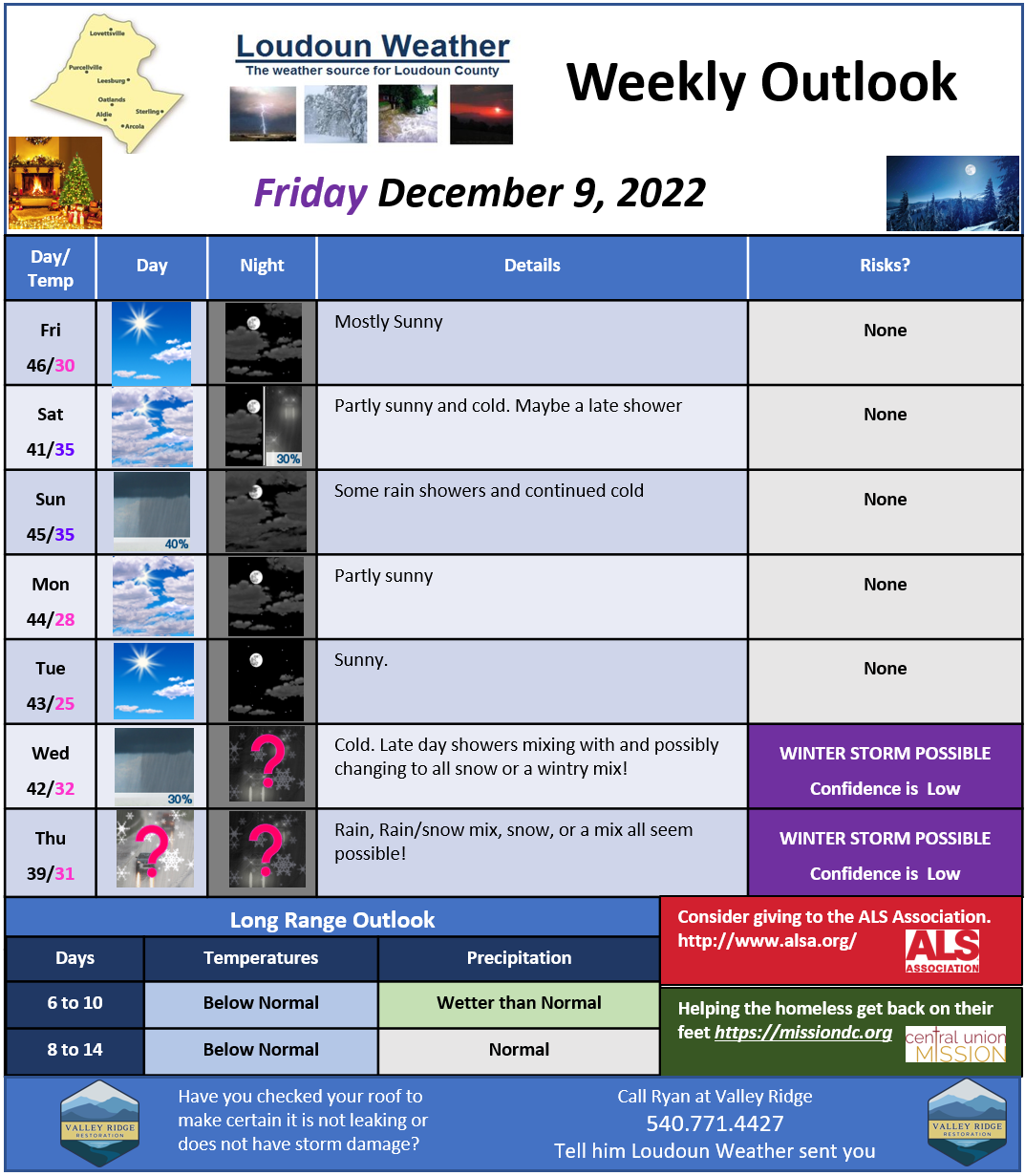
Loudoun County Weather Outlook for Friday, December 9, 2022


I know I have been a bit down on the pattern, but it looks like things may have been delayed and not denied! The long-range still holds potential for a wintrier pattern. The first piece in the puzzle DOES come into play this week is the Negative NAO. That may be a bit technical, but it sets up a block for storms moving along in the jet stream, which could help form bigger storms, AND keep colder air from retreating so that *COULD* mean some snow or frozen precipitation!
The pattern will be strange this week, and we have a front nearby with several waves of energy. That means that starting Tuesday through Friday, we could see daily showers. Tuesday looks the wettest, whereas the rest of the week looks like showers, although Thursday may turn wetter overnight.
The following week, things *COULD* become better oriented as better cold air and blocking continue, and we get some other energy coming close by! I need to temper any excitement and remember that the models struggle when patterns change. The biggest part of the miss for this week was trapping the cold air on the right side of the block so it would be in our “backyards” for any storms. That was missed big time by models, and they forecasted it would be here! It was not!
This week will be seasonably mild and above normal Thursday before the cooler next weekend.
A more detailed forecast will be posted tomorrow!
All for now
