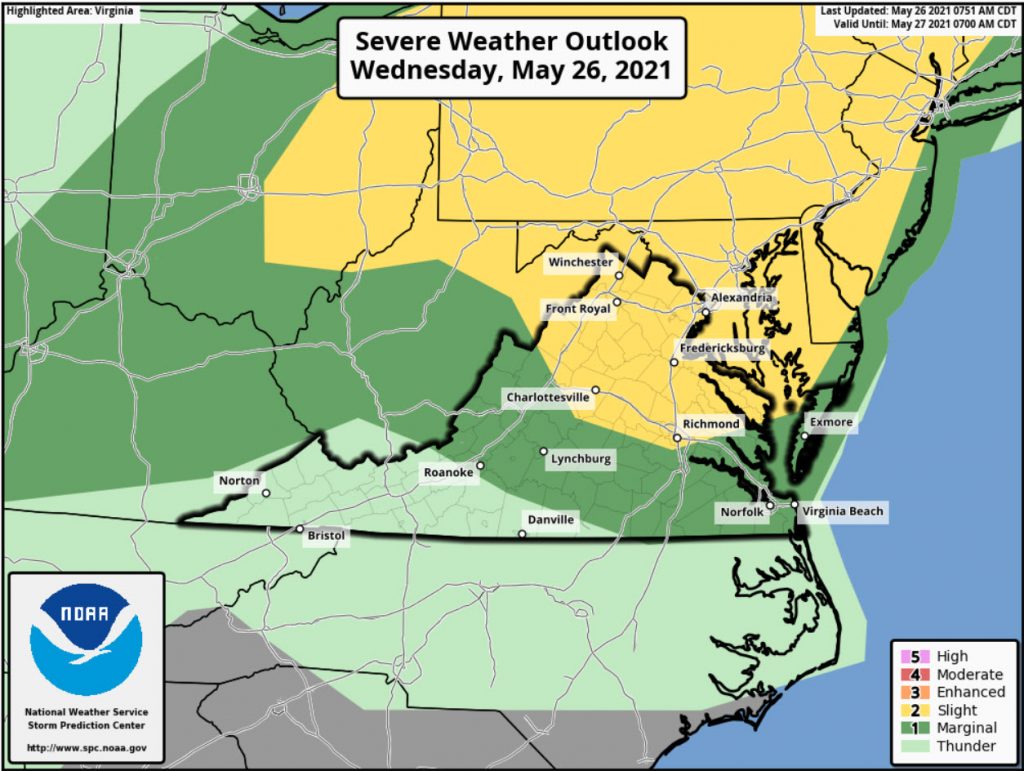
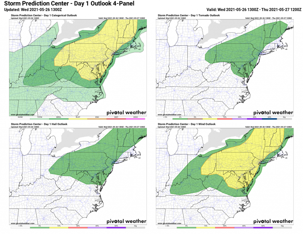
Good chance of Severe today so please be on the lookout.
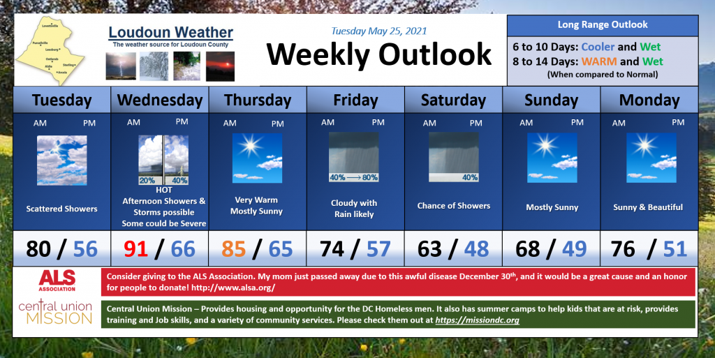
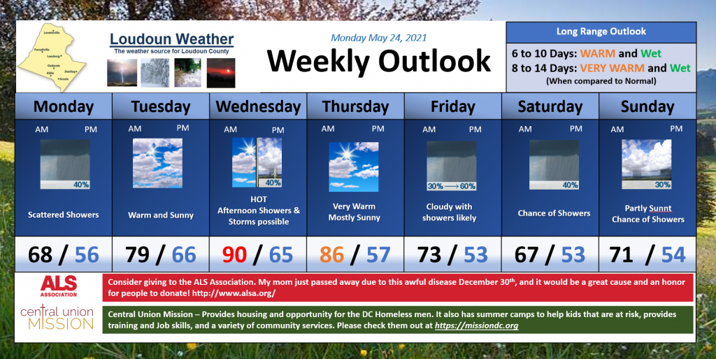
Hot and Humid conditions. Very nice tomorrow. Rain chances Friday and Saturday with nice Sunday and Memorial Day!
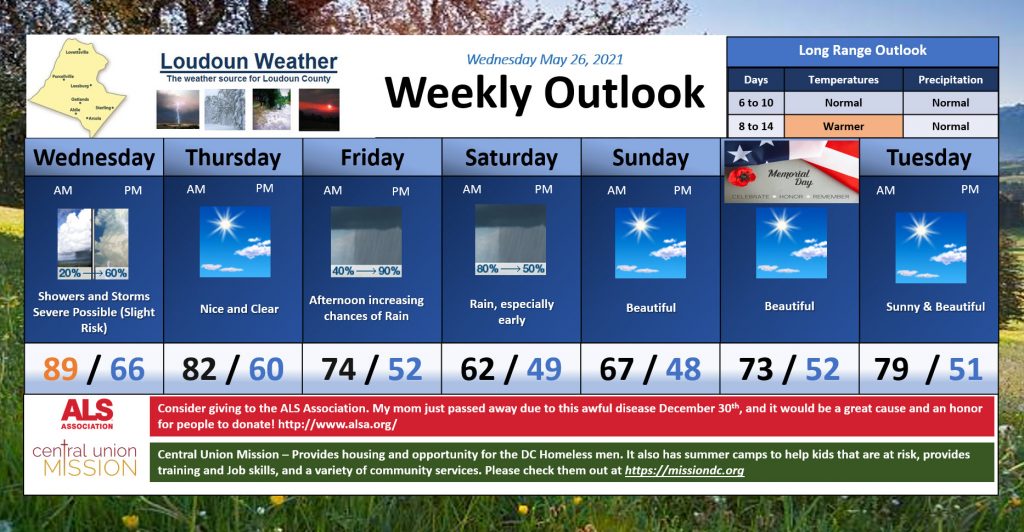
Mostly cloudy today and warmer. Tomorrow will be hot and have a chance of strong to severe storms. The weekend starts wet but turns beautiful.. however, the temps will be very cold!
Apologize for my absence. Finally a break in the Heat with a front that is pushing through today. It only is bringing a little rain along with it. Maybe it will help wash a bit of pollen out of the air, but, unfortunately the outcome is less than ideal for the very dry conditions we are experiencing.
Get this type of post in an email.
The dome of high pressure that WTOP.com (and CNN) are sharing is not uncommon, but the location has been less than ideal as it has kept us dry and our first heat for the summer 2021 season. I hate the heat, but fortunately, the winds and drier air made it a bit more tolerable. The heat did wake up the dormant Cicadas that had been slow to get their act together! But, officially, they are here! They sound like aliens in the trees. I have not seen too many in my backyard, but I am on old farmland. I hear them in the trees at Franklin Park and have heard plenty about it on Nextdoor as well as watched the increase in the Cicada Safari App. They still are not at peak, so I expect to hear more, and your ground may crunchy at this point. The Washington Post had a great article on the Cicadas, and Kevin Ambrose made a great plot of what was reported by readers.
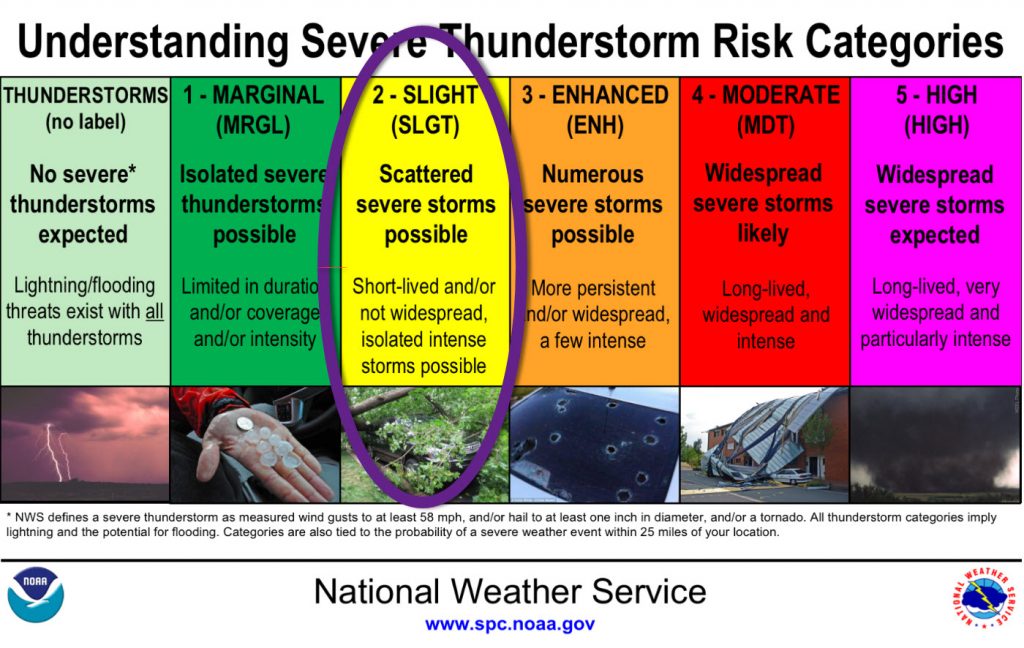
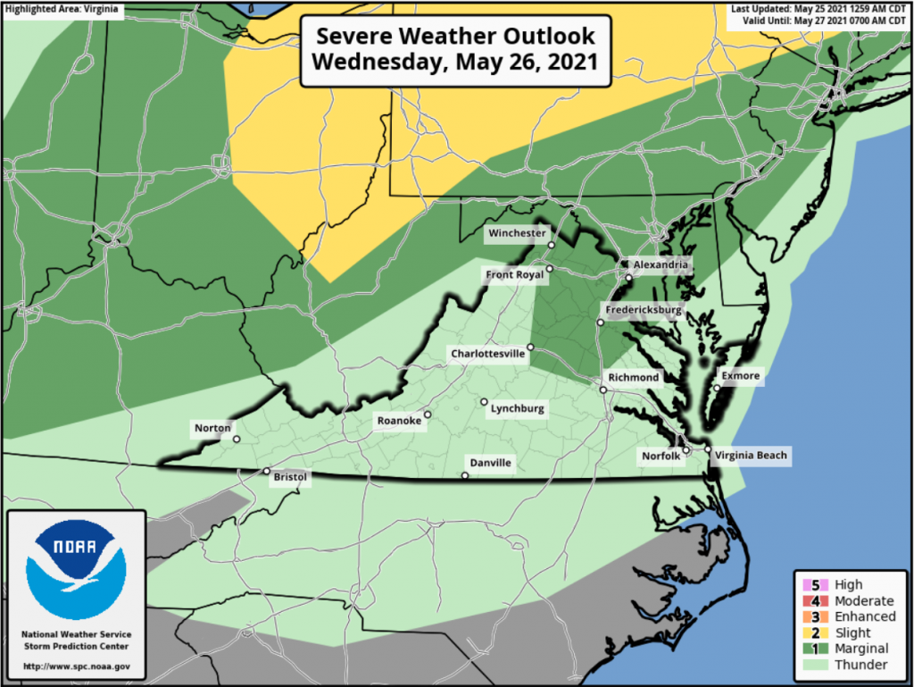
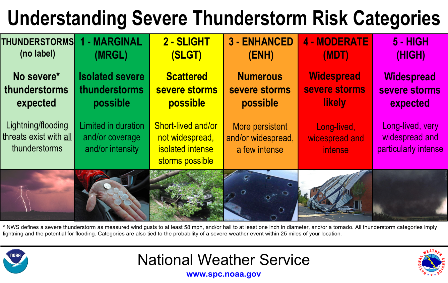
As far as the week goes, we will be down, then up, then down. Rain today will be light, but keep us much cooler than this last weekend. We will heat up on Wednesday and could see some strong to severe storms in the afternoon. The Storm Prediction Center has outlined the area with a marginal risk for severe storms. A Marginal Risk means that we have a chance for an isolated, short-lived severe storm.
By Friday a front looks like it will sag through the area and end up stalling in the area! That is not good for the weekend sunny outlooks of BBQs and pool openings! We may FINALLY get a little more significant rains, but the exact location of where the most rain falls is still up in the air. There is a concern it could shift south. You can see the current 7-day outlook from the Weather Prediction Center that highlights more precip to the south, which makes sense because the front will be hung up to the south.
The Long Range
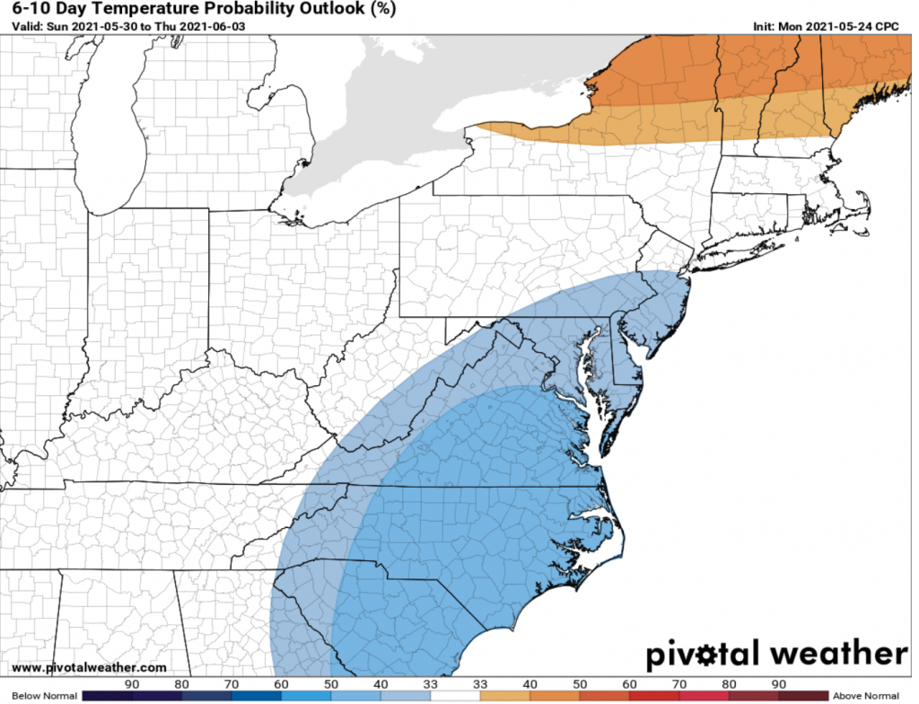
Looks like after the cooler conditions this coming weekend, warmer than normal temps will return, but maybe some better chances of rain, which we need!
Outlook from the Climate Prediction Center and Graphics by Pivotal Weather